Local Dirt: South Albany Half
This post was written before VT Governor Phil Scott’s Shelter in Place order, and the subsequent closure of the Center. While running and outdoor exercise remains viable under this order, think carefully about your exposure and what you’re exposing others too before driving anywhere to run.
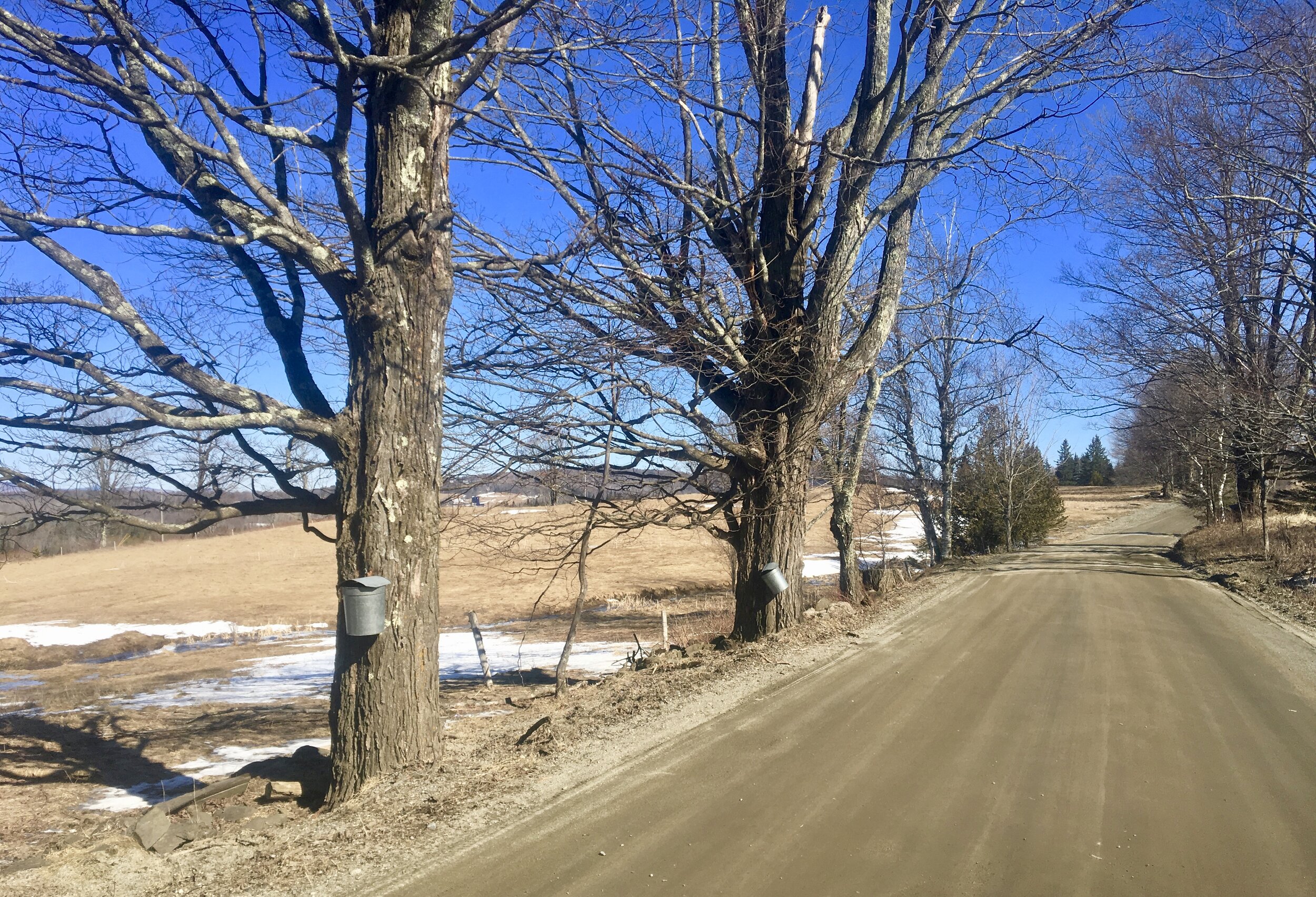
Mud season is officially here - time to take to the roads for some sloppy dirt road adventuring! This month’s edition of Local Dirt spotlights the spectacular South Albany Road, a 5.5 mile rolling dirt road connecting South Albany to East Craftsbury. Sitting high and lined by open farmland, South Albany Road boasts stunning views of Mount Mansfield, Belvidere Mountain, and the Lowell Mountain Range. This loop covers the perfect half marathon distance of 13.1 miles and is a great option for a quiet, hilly long run. Below is a description of the route, followed by a few suggestions.
Distance: 13.1 miles
Max elevation: 1476’
Elevation gain: 1394’
Terrain: Consistently rolling hills, with two climbs over one mile long.
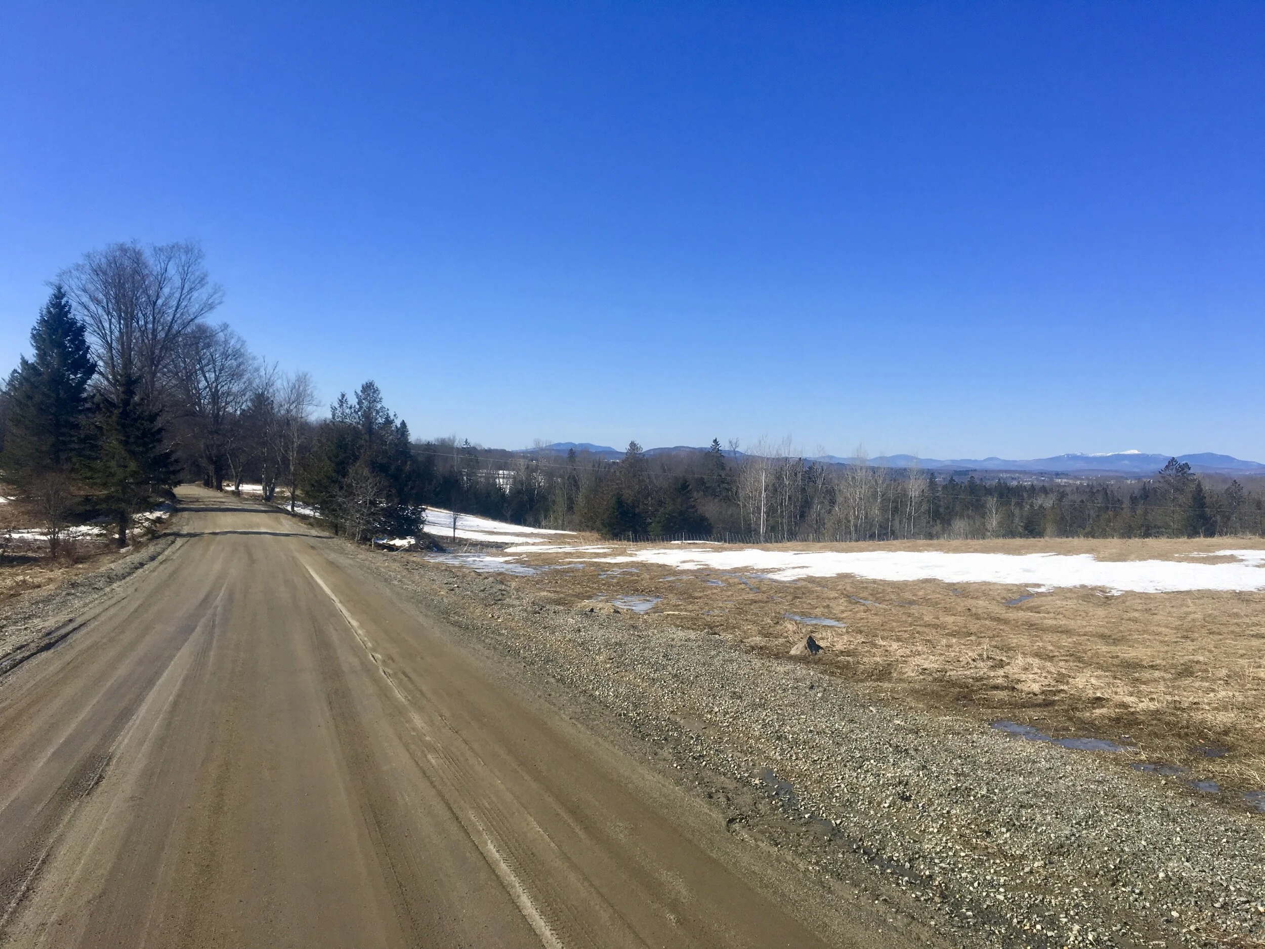
Conditions when previewed: Clear blue-bird, blustery day in the low 20s.
Route: From the Outdoor Center, head North on Lost Nation Road towards Albany. At 2.3 miles, turn right onto Page Pond Road for half a mile before bearing right at the three-way intersection to turn onto Creek Road. At 3 miles turn left onto South Albany Road to climb the longest hill of the day, covering a 1.4 mile steady ascent. The road opens up into wide, expansive farm fields at the top of the climb and the high point of the loop, 1476’.
Next, turn right at the unmarked T intersection at 4.4 miles and then bear left at 4.5 miles to continue on South Albany Road. Enjoy the rolling undulations of this high, open road with spectacular views of Mount Mansfield, Mount Belvidere, and the Lowell Mountain Range. Stay straight on South Albany Road to pass by Andersonville Road, Mud Island Road, Allen Hill Road, and Echo Hill Road.
South Albany Road ends at 8.4 miles in the village of East Craftsbury. At road’s end, turn right onto Ketchum Hill Road. At the bottom of Ketchum Hill’s mile-long descent, turn left to return to Creek Road at 9.5 miles. At 10 miles, turn right onto King Farm Road for the second long climb of the day, with 1.3 miles of continuous climbing. Stay straight at 11.1 miles and bear right at 11.4 miles to continue on King Farm Road. At 11.8 miles, continue straight through the intersection to join Mill Village Road. Turn right at 12.5 miles for one final, steep hill before arriving back at the Outdoor Center. Views earned, and half marathon complete!
Heidi’s Helpful Hints:
Do it on a clear day! While these rolling hills are always worthwhile, I recommend saving this run for a clear sunny day to fully enjoy the South Albany vistas.
I typically run this loop clockwise. Run counter-clockwise, the route begins with three miles of notable descent just before the long, grueling uphill of Ketchum Hill Road. I often find it easier on the legs to begin with more evenly rolling terrain, but both directions are quite enjoyable. Either way, the major climbs are spaced out throughout the run with plenty of relaxed rolling in between. Plus, switching up the direction you run the loop gives you different views of the glorious mountains!
This loop is an excellent alternative to the traditional 10 mile Creek Road loop, with longer climbs and more expansive views of the surrounding ridge lines and mountain ranges. Use this route as an opportunity to mix it up when you’re ready to go a bit longer!
Want a shorter option on South Albany Road? Park in East Craftsbury Village and head north on South Albany Road for a nice out and back outing. Or park at the northern end of South Albany to make a 6-7 mile loop connecting South Albany Road to Creek Road via Allen Hill Road and Seaver Brook or Urie Roads.